
Page 133 - Greystones Archaeological Historical Society
P. 133
GREYSTONES ARCHAEOLOGICAL & HISTORICAL SOCIETY JOURNAL VOLUME 8
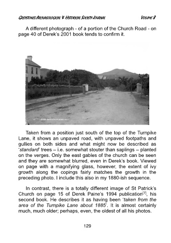
A different photograph - of a portion of the Church Road - on
page 40 of Derek’s 2001 book tends to confirm it.
Taken from a position just south of the top of the Turnpike
Lane, it shows an unpaved road, with unpaved footpaths and
gullies on both sides and what might now be described as
‘standard’ trees – i.e. somewhat stouter than saplings – planted
on the verges. Only the east gables of the church can be seen
and they are somewhat blurred, even in Derek’s book. Viewed
on page with a magnifying glass, however, the extent of ivy
growth along the copings fairly matches the growth in the
preceding photo. I include this also in my 1880-ish sequence.
In contrast, there is a totally different image of St Patrick’s
[7]
Church on page 15 of Derek Paine’s 1994 publication , his
second book. He describes it as having been ‘taken from the
area of the Turnpike Lane about 1885’. It is almost certainly
much, much older; perhaps, even, the oldest of all his photos.
129